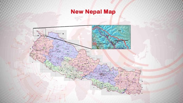
Nepal's Controversial Political Map Involving Indian Territory Passed By Upper House

Nepal's Upper House of the Parliament has approved a new political map of the country involving Indian territory. All 57 members gave their approval in support of the bill and no one opposed it. Earlier, a new political map and new logo of Nepal has been passed in the lower house of the Nepali Parliament. In this map, Lipulekh, Kalapani, and Limpiyadhura are described as part of Nepal, which is currently in Indian territory. The release of the new map of Nepal is considered a major setback on India's foreign policy front.
Now the President of Nepal Vidya Devi Bhandari is due to sign the bill, after which the new map will take legal form and the logo of Nepal will be changed. In the new map, Nepal has declared Lipulekh, Kalapani, and Limpiyadhura as part of the Sugauli Treaty of 1816.
If it takes the form of law, the relations between India and Nepal are bound to get bitter. The border dispute between India and Nepal erupted when a road in Lipulekh was constructed to connect Kailash Mansarovar. Nepal had released a map of their country on 20 May, expressing reservations over it. Since then, the relationship between the two countries has soared.
Latest Videos


