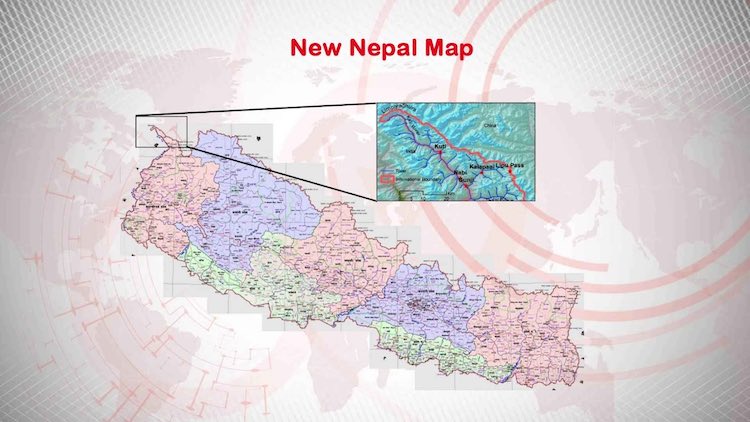
New Nepal Map Which Includes 'Indian Areas' Approved In Nepalese Parliament

The Constitution amendment bill for adopting the new political map of Nepal and the adoption of the new logo was passed by consensus in the lower house of the parliament. In this map, Lipulekh, Kalapani, and Limpiyadhura are described as part of Nepal, which is currently in Indian territory. Releasing the new map of Nepal is considered a major setback on India's foreign policy front.
The bill was introduced in the House of Representatives by the Law Minister of Nepal, Shiv Maya Tumbahangpe, and all parties supported it including Nepali Congress, Janata Samajbadi Party, Nepal Mazdoor Kisan Party, and Rashtriya Janam Morcha. Now the bill is only to be signed by the President of Nepal, Vidya Devi Bhandari, after which the new map will take legal form and the logo of Nepal will be changed. In the new map, Nepal has declared Lipulekh, Kalapani, and Limpiyadhura as part of the Sugauli Treaty of 1816.

If it takes the form of law, the relations between India and Nepal are bound to get bitter. Nepal's deputy PM Ishwar Pokhriyal said that ‘we will find a solution to this dispute through dialogue. It has always been our opinion.’
There is no point in deploying the army. Nepali Foreign Minister Pradeep Kumar Gyawali says that Nepal wants to negotiate with India and there is no other way.
Gyawali also said that historically the Kali River has been the border between Nepal and India and they will discuss with India the historical evidence. However, India has not yet responded to this step of Nepal.
The border dispute between India and Nepal erupted when a road in Lipulekh was constructed to connect Kailash Mansarovar. Nepal had released a map of their country on 20 May, expressing reservations over it. Since then, the relationship between the two countries has soared.
Latest Videos


