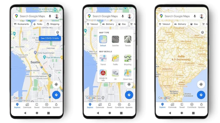
Google Maps Gets ‘COVID Layer’ To Highlight Coronavirus Hotspots For Safer Travel

Google recently announced that the tech giant is rolling out the ‘COVID layer’ feature in Maps, a tool that shows critical information about COVID-19 cases in an area for safer travel during the pandemic.
Tapping on the layers button on the top right-hand corner of the mobile screen and clicking on “COVID-19 info” will give users a seven-day average of new COVID cases per 100,000 people for the area and a label will indicate whether the cases are going up or down.
‘Color coding also helps you easily distinguish the density of new cases in an area,’ says Maps product manager Sujoy Banerjee in a blog post.
Data shown in the COVID layer is derived from multiple authoritative sources, including Johns Hopkins, the New York Times, and Wikipedia. These sources get data from public health organisations like the World Health Organization, government health ministries, along with state and local health agencies and hospitals.
“While getting around is more complicated these days, our hope is that these Google Maps features will help you get where you need to be as safely and efficiently as possible. The COVID layer starts rolling out worldwide on Android and iOS this week,’” the blog further states.
Latest Videos


